Ground TruthMade possible by YelloSKYE Solutions
Ground TruthMade possible by YelloSKYE Solutions
Request
a Demo
Request
a Demo
Our Solutions
Our advanced aerial imagery and data analytics solutions deliver business intelligence that can make your business more accurate, smarter, and transform the way you manage your assets. We offer four customizable, high-tech services that are built to fit and solve your business needs.
Asset Risk Management Services
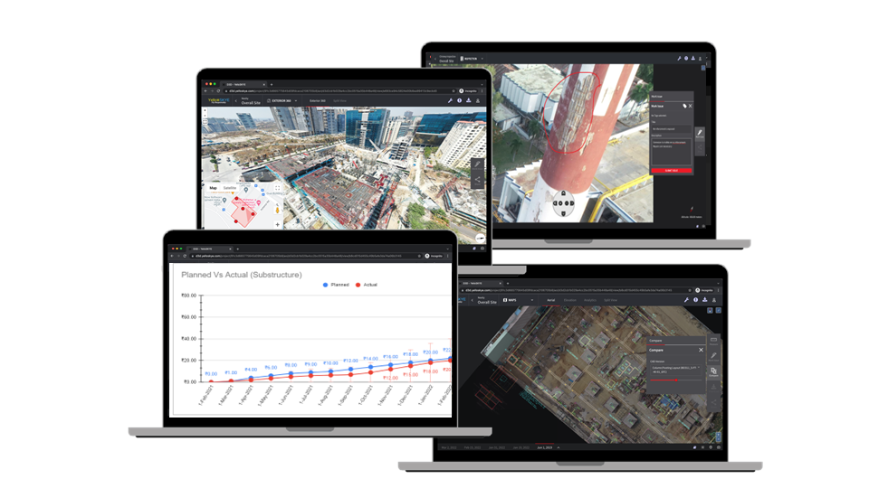
Monitor progress, save time and money, and replace manual inspections with drone surveillance. We create a virtual, real-time, 2D/3D model of your asset and deliver business insights via a custom platform.
Suitable for:
- Wind & Solar Assets
- Construction & Engineering
- Banking, Finance, Insurance
- Security & Surveillance
Media, Marketing, Entertainment Services
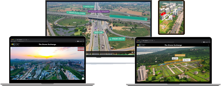
Give your audience a unique view of your offerings, and engage them with hi-res, high quality drone footage. We build your business an easy-to-navigate digital asset library with 360 degree, indoor and outdoor, video or photographic outputs.
Suitable for:
- Advertising and Communications
- Cinematography
- News & Broadcasting
- Media
Aerial Intelligence
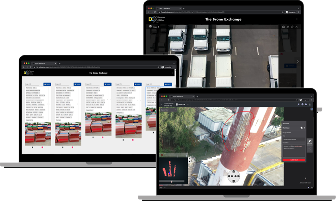
Track your assets, inspect quality, predict risks to prevent liabilities, and reduce delays with drone inspection. We help you count, locate, measure, read, and compare your assets by using AI and ML powered insights derived from the aerial imagery we capture for you.
Suitable for:
- Manufacturing & Industry
- Open Stockyard Inventory
- Management Warehousing
- Defect Identification
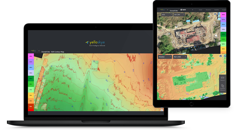
yelloSKYE Maps
Bolster your development and planning initiatives with in-depth drone mapping. We help you digitize any area and derive data from it through a custom-built, interactive, digital map created to suit your business needs.
Suitable for:
- Smart Cities
- Municipal Corporations
- Industrial Development
- Wildlife, Forestry & Fishery Departments

Our Platform
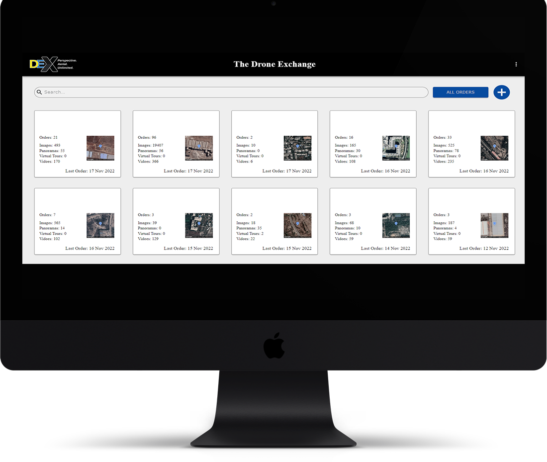
YelloSKYE Drone Exchange (DEX)
A proprietary platform that provides next-gen enterprises with the ground truth, allowing them to make data-driven decisions to protect their assets, minimize risks, save time, and monitor progress anytime, anywhere.
How It Works
Easy access, no downloads
No software downloads or installations needed, our cloud-based platform can be accessed on a web browser across devices, anytime, anywhere.
Enterprise login
Personalized login access for each customer to review their entire assets library in a single window access.
Team collaboration
Quick sharing, reviewing, comparing, and collaboration options within your team: share/restrict access with a single click.
Data & analytics
Business intelligence and actionable insights for accurate decision making delivered through verifiable imagery and contextualized analysis of your data.
Seamless integration and adoption
Our platform integrates with legacy systems and softwares like AutoCAD easily so your team can continue existing processes.
CEO Dashboard view
An intuitive dashboard that gives instant reports, insights and analytics so that you can have a bird’s eye view of your business anytime, anywhere
Cloud based, fully encrypted, secure